My dad is riding is bike across the US. Here is his itinerary: http://www.americabybicycle.
Personally, I think he's crazy do it. However, I am so proud of him. I think he's a pretty fantastic person.
Day 1
Hi All
The first leg of TEA (Tom's Excellent Adventure)
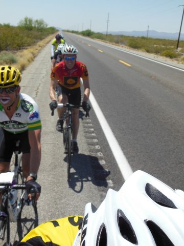
is complete, Costa Mesa to Palm Springs, 118 miles. Very slow going for
the first 50 miles, lots of surface streets and bike paths. The last
part of the ride was hot and windy, tailwind for 10 miles, then a nasty
headwind for the last 15 in Palm springs. Only had 1 flat 2 miles from
the finish.
Here is my Garmin link for day 1
Day 2
Hi All
Going to try another update. Susan said the first one was boring, what, she think she's married to frickin Bill Bryson?
Day
2 was Palm Springs to Blythe, 136 miles. Big surprise, it was hot,
over 100 degrees in some places. I had a great solution, I bought a
pair of panty hose (control top, queen size) in Palm Springs. Given it
was Palm Springs, the clerk didn't give me a second look. Once it got
hot, I filled the hose with ice and stuck it in my jersey. I repeated at
each rest stop and it worked like a charm. Unfortunately, two of the
riders are at the ER now getting IV's for heat exhaustion, but they are
OK.
The highlight of the ride (besides the George Patton
Desert Warfare Museum) was the Box Canyon segment. It is a gradual
climb over about 15 miles up to 2000 ft through some great rock
formations. The road is in decent shape, and there is absolutely no
traffic. The lowlight was 40 miles riding on the shoulder of I-10.
Also for your viewing pleasure I have included a picture of yours truly after todays ride.
Here is the Garmin link for day 2

Days 3 and 4
Just finished day 4 of my ride. Day 3 was nothing to
write about, it didn't seem worth an update last night. We rode 35
miles east on I-10 out of Blythe CA over the AZ border in nasty
crosswinds, than 90 miles east on AZ 63 into the same winds with the
temp going into the high 90's. It was one of those days that you can
never get a good draft. Rte 63 has to be one of the straightest roads
in the US, not much to see in that part of Arizona. By the time we
arrived in Wickenburg we were beat. For your viewing pleasure I
included some pictures of of our scenic lunch stop serving gourmet
peanut butter and vintage gatorade. Also, my Dutch friend Floris took a
few action shots of our raggedy ass paceline with what he called "the
joker in the desert."
Day 4 was great. We had 3 major climbs totaling
9,000 feet with perfect weather. It was a real contrast to hit the pine
forests outside of Prescott, after spending 3 days in the desert. The
last climb summited at 7000 ft, followed by a great descent through old
mining town of Jerome. Tonight we are in Cottonwood AZ, than Winslow
tomorrow.
Time to put more Bag Balm on the tush, than off to bed.
Here is my garmin link for days 3 and 4:


Day 5
On day 5 of TEA we rolled out of Cottonwood
AZ with excellent conditions, bright and sunny with little wind and
temp in the high 50's. Route 89A gradually climbs 15 miles to Sedona AZ
and it's famous red rock formations. As you leave Sedona the road winds
through Oak Creek Canyon, and over the next 15 miles you climb to 7000
ft and some amazing views. We had our lunch break in Flagstaff, and
then headed East. We picked up a nice tailwind and made it down I-40 at
about 25-30 mph, ending up in Winslow AZ, which is a rather grim town.
I'm getting some snide remarks from some on my low
average speed. I've got lots of excuses, but the main reason is I never
turn the Garmin off when I stop, it runs all day. The other excuse is
that I am almost 60.
All The Best
Tom
Here is my garmin link for day 5
Day 6
Hi
Today we rode from Winslow AZ to
Gallup NM. Not a very complicated route, get on I-40 and head east. It
was scheduled to be 134 miles, but we had our first glitch. At mile 40
we encountered construction, and the state police would not allow bikes
because there was no shoulder. We had to shuttle in vans and lost 10
miles, not a big deal.
The ride itself was okay, temperature in the 60's
and a combination cross/tailwind. Even though the route is a gradual
uphill with 3500 ft of climbing we were able to average 20 mph for the
day.
On to Albuquerque tomorrow.
Tom
Here is the garmin link for day 6:
http://connect.garmin.com/
No comments:
Post a Comment