Tuesday, April 30, 2013

Day 10

Hi

I had an amazing day 10 on my cross country bike trip.  We rode out of Las Vegas on one of the best roads for biking that I have ever encountered.  Rt. 104 stretches east for 107 miles to Tucumcari NM.  En route there are no towns, and only one gas station/store at the 75 mile mark.  The isolation was incredible.  During the entire ride we probably encountered a total of 30 cars /trucks, we had the road to ourselves.  The scenery was stark, and in places you could see for miles in all directions.

I had a Garmin malfunction on the ride, so no link at this time.  I did include the Strava link for Floris, who rode with me all day.  Ride stats were; 108 mile, avg. 21.2 mph, 3100 ft of climbing.  Thanks for the tailwind.

Tomorrow is Dalhart, TX, already entering the central time zone.

Tom


http://www.strava.com/activities/51603863


If you see this man dial 1-800-CALLFBI

Monday, April 29, 2013

Day 9

Hi

Sunday (day 8) was a rest day, so I was able to spend the day with my mom in Albuquerque, and she is doing well.

Today we rode to Las Vegas NM.  It was long, 135 miles with 8,000 feet of climbing.   There were lots of memories rolling through Albq, and I bet I bored all my riding mate with my stories.  We got out of town via old Rte 66,  then north on Rte 14,  climbing behind the Sandia mountains.  We passed through Madrid, an old mining town that is morphing into a combination of a funky artist colony/tourist trap, then had about 20 miles of fast rollers with great pavement and no traffic. We rode around Santa Fe, and stopped for lunch in Hondo.  Then unfortunately more interstate, this time I-25.  We had 30 miles of great tailwinds, then 10 miles in your face at the end.

Then I finished the ride with a large chocolate shake from DQ:

PS  zinc oxide, not celebrity picture for Got Milk? ad

Time for bed.

Tom

http://connect.garmin.com/activity/305448344

Sunday, April 28, 2013


Hi All

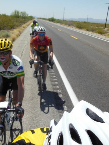
Day 7 is complete and we had a good ride from Gallup to Albuquerque.  It was long (136 miles), but favorable  conditions, sunny with wind speeds less that 10mph.  It was cold at the start, below 30, but it warmed up quickly.  There was a decent climb up to the Continental Divide to 7300 ft where we had our first SAG stop.  Then the ride went along the old Rte 66 for about 50 miles.  The scenery was great and traffic was light.  We then hopped on to I-40 for 35 miles.  It is a gradual downhill and we had light winds. It is tough riding a pace line on the interstate due to all the debris on shoulder.  The biggest hazard are the shredded pieces of truck tire.  the wires from the radial work their way into our tires and caused multiple flats.  I think this is the last of the interstates. 

I've been riding with 3 other guys that have a similar pace. One is Dave Pramann from Minnesota.  When he heard I was from SLO he pullled up a picture on his phone of him beating Chris Black in a photo finish.  He has completed several IditaBike races, (350 miles in Alaska mid winter). Another is Floris van Overveld, a club rider from Amsterdam.  And finally Roger Egli, a Swiss who now lives in Vail.

Floris is becoming initiated to American lingo.  During one ride Big Tom ( as opposed to me, Little Tom) had this exchange with Floris:

                  Big Tom: I've got a real growler going on
                  Floris: What? ( looking puzzled)
                  Big Tom: You know, I need to drop the kids at the pool
                  Floris: Huh?
                  Big Tom: I'm prairie doggin'
                  Floris: ( in perfect english) are you referring to deefaction?  (with particular emphasis on the long e)

If you don't think that's funny, I guess you had to be there.

After a week I have picked up valuable, but very random knowledge:

-efferdent tablets keep mold from growing in water bottles
-if you use too much chamois ceam you shorts foam when you sweat 
-fig newtons are te easiest thing to eat in a 22mph pace line
-if you eat a whole sleeve of fig newtons, see above exchange with Floris

Off to LasVegas NM tomorrow.

Thanks for reading.

Tom

http://connect.garmin.com/activity/304237534

Saturday, April 27, 2013

Tom's Excellent Adventure (Catching Up Since We Are Starting the Blog 6 Days Late!)

My name is Laura. My dad is Tom. Since he is "computer challenged." I have created a blog for him.

My dad is riding is bike across the US.  Here is his itinerary: http://www.americabybicycle.com/Fast/FastPop.htm

Personally, I think he's crazy do it. However, I am so proud of him. I think he's a pretty fantastic person.
 
 
Day 1

Hi All

The first leg of TEA (Tom's Excellent Adventure) is complete, Costa Mesa to Palm Springs, 118 miles. Very slow going for the first 50 miles, lots of surface streets and bike paths. The last part of the ride was hot and windy, tailwind for 10 miles, then a nasty headwind for the last 15 in Palm springs. Only had 1 flat 2 miles from the finish. 
Here is my Garmin link for day 1
Day 2
Hi All

Going to try another update.  Susan said the first one was boring, what, she think she's married to frickin Bill Bryson?

Day 2 was Palm Springs to Blythe, 136 miles.  Big surprise, it was hot, over 100 degrees in some places.  I had a great solution, I bought a pair of panty hose (control top, queen size) in Palm Springs.  Given it was Palm Springs, the clerk didn't give me a second look. Once it got hot, I filled the hose with ice and stuck it in my jersey. I repeated at each rest stop and it worked like a charm. Unfortunately, two of the riders are at the ER now getting IV's for heat exhaustion, but they are OK.

The highlight of the ride (besides the George Patton Desert Warfare Museum) was the Box Canyon segment.  It is a gradual climb over about 15 miles up to 2000 ft through some great rock formations.  The road is in decent shape, and there is absolutely no traffic.  The lowlight was 40 miles riding on the shoulder of I-10.

Also for your viewing pleasure I have included a picture of yours truly after todays ride. 
Here is the Garmin link for day 2 
 
Days 3 and 4

Just finished day 4 of my ride.  Day 3 was nothing to write about, it didn't seem worth an update last night.   We rode 35 miles east on I-10 out of Blythe CA over the AZ border in  nasty crosswinds, than 90 miles east on AZ 63 into the same winds with the temp going into the high 90's. It was one of those days that you can never get a good draft.  Rte 63 has to be one of the straightest roads in the US, not much to see in that part of Arizona. By the time we arrived in Wickenburg we were beat.  For your viewing pleasure  I included some pictures of of our scenic lunch stop serving gourmet peanut butter and vintage gatorade.  Also, my Dutch friend Floris took a few action shots of our raggedy ass paceline with what he called "the joker in the desert."  

Day 4  was great.  We had 3 major climbs totaling 9,000 feet with perfect weather.  It was a real contrast to hit the pine forests outside of Prescott, after spending 3 days in the desert. The last climb summited at 7000 ft, followed by a great descent through old mining town of Jerome.  Tonight we are in Cottonwood AZ, than Winslow tomorrow.

Time to put more Bag Balm on the tush, than off to bed.
Here is my garmin link for days 3 and 4:


Day 5
On day 5 of TEA we rolled out of Cottonwood AZ with excellent conditions, bright and sunny with little wind and temp in the high 50's. Route 89A gradually climbs 15 miles to Sedona AZ and it's famous red rock formations.  As you leave Sedona the road winds through Oak Creek Canyon, and over the next 15 miles you climb to 7000 ft and some amazing views.  We had our lunch break in Flagstaff, and then headed East.  We picked up a nice tailwind and made it down I-40 at about 25-30 mph, ending up in Winslow AZ, which is a rather grim town.

I'm getting some snide remarks from some on my low average speed.  I've got lots of excuses, but the main reason is I never turn the Garmin off when I stop, it runs all day.  The other excuse is that I am almost 60.

All The Best

Tom

Here is my garmin link for day 5
Day 6
Hi 

Today we rode from Winslow AZ to Gallup NM. Not a very complicated route, get on I-40 and head east.  It was scheduled to be 134 miles, but we had our first glitch.  At mile 40 we encountered construction, and the state police would not allow bikes because there was no shoulder.  We had to shuttle in vans and lost 10 miles, not a big deal.

The ride itself was okay, temperature in the 60's and a combination cross/tailwind.  Even though the route is a gradual uphill with 3500 ft of climbing we were able to average 20 mph for the day.  

On to Albuquerque tomorrow.

Tom 
Here is the garmin link for day 6:
http://connect.garmin.com/activity/303667387